First ever Atlas of Clouds
We say that French botanist and zoologist
Jean-Baptiste Lamarck was the first who proposed a system of identifying
clouds in 1802, and English naturalist Luke Howard proposed a better
system in 1803. With slight modification, Howard’s system is still in
use. Howard’s system uses Latin words to describe clouds as they appear
to an observer on the ground. High wispy clouds are called cirrus (from
the Latin word for curl of hair); sheet-like clouds are called stratus
(from the Latin word for layer); billowing, puffy clouds are called
cumulus (from the Latin word for heap); and rain-producing clouds are
called nimbus (from the Latin word for rain).
However, this is not the whole truth since
identification and classification of clouds had since been told and
written as back as 7th century AD. It was for people to have read it.
Here is it explained:

[Refer 2:57]
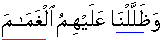
[Refer 7:160]

[Refer 2:210]
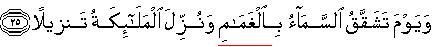
[Refer 25:25]

"Have you
seen/pondered about the water which you drink?
Is it you who shed it from the white shiny cloud, or are We the Shedder?
Were it Our Will, We could salinize it
{rendering it non-drinkable): then why do you not express gratitude?
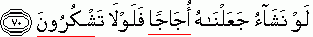
{Refer 56:68-70}
Let us say الحمد
لله

"And We sent water heavily
showering from the squeezer fluffy clouds; that We may with that bring
out grain crops and plants {all sort}" {Refer 78:14-15}
Cumulonimbus clouds:
a large white or gray cloud with a flat base
and a rounded fluffy top, or a mass of such clouds, developing as a
result of rising hot air currents. Clouds of this type range in height from less than 1.6 km (1 mi) to
more than 13 km (8 mi) above the earth. Two main forms are included in
this group. Cumulus clouds are dome-shaped, woolpack clouds most often
seen during the middle and latter part of the day, when solar heating
produces the vertical air currents necessary for their formation. These
clouds usually have flat bases and rounded, cauliflower like tops.
Cumulonimbus clouds are dark, heavy-looking clouds rising like mountains
high into the atmosphere, often showing an anvil-shaped veil of ice
clouds, false cirrus, at the top. Popularly known as thunderheads,
cumulonimbus clouds are usually accompanied by heavy, abrupt showers.
The first scientific study of clouds began in 1803,
when a method of cloud classification was devised by the British
meteorologist Luke Howard. The next development was the publication in
1887 of a classification system that later formed the basis for the
noted International Cloud Atlas (1896). This atlas, considerably revised
and modified through the years (most recently in 1956), is now used
throughout the world.
Cumulonimbus (Cb) is a type of
cloud that is tall,
dense, and involved in
thunderstorms and other inclement
weather. Cumulonimbus
originates from Latin:
Cumulus "accumulated" and nimbus "rain". It is a result of
atmospheric instability. These clouds can form alone, in clusters,
or along a cold front
in a squall line. They
create lightning
through the heart of the cloud. Cumulonimbus clouds form from
cumulus clouds (namely from
cumulus congestus) and can further develop into a
supercell, a severe
thunderstorm with special features.
....................
أَفَرَأَيْتُمُ ٱلْمَآءَ ٱلَّذِي تَشْرَبُونَ
"Have you seen/pondered about the water which you drink?
أَأَنتُمْ أَنزَلْتُمُوهُ مِنَ ٱلْمُزْنِ أَمْ نَحْنُ ٱلْمُنزِلُونَ
Is it you who liquefy/shed it from the
white shiny cloud, or are We Who Shed it?
In almost all what have been termed “Mothers
of Tafseer”, ٱلْمُزْنِ has been translated as السحاب and then some
stated هو السحاب الأبيض. But السحاب is never الأبيض.
تفسير جامع البيان في تفسير القرآن/ الطبري
يقول تعالى ذكره: أفرأيتم أيها الناس الماء الذي تشربون، ءأنتم أنزلتموه من
السحاب فوقكم إلى قرار الأرض، أم نحن منزلوه لكم. وبنحو الذي قلنا في معنى
قوله المُزن، قال أهل التأويل. ذكر من قال ذلك:
حدثني محمد بن عمرو، قال: ثنا أبو عاصم، قال: ثنا عيسى وحدثني الحارث قال:
ثنا الحسن، قال: ثنا ورقاء جميعاً، عن ابن أبي نجيح، عن مجاهد، في قوله: {
مِنَ المُزْنِ } قال السحاب.
حدثنا بشر، قال: ثنا يزيد، قال: ثنا سعيد، عن قتادة قوله: { أأنْتُمْ
أنْزَلْتُمُوهُ مِنَ المُزْنِ } أي من السَّحاب.
حدثني يونس، قال: أخبرنا ابن وهب، قال: قال ابن زيد، في قوله: { أأَنْتُمْ
أنْزَلْتُمُوهُ مِنَ المُزْنِ } قال: المزن: السحاب اسمها، أنزلتموه من
المزن، قال: السحاب.
حدثني محمد بن سعد، قال: ثني أبي، قال: ثني عمي، قال: ثني أبي، عن أبيه، عن
ابن عباس، في قوله: { أنْزَلْتُمُوهُ مِنَ المُزْنِ } قال: المزن: السماء
والسحاب.
تفسير الكشاف/ الزمخشري
و { ٱلْمُزْنِ } السحاب: الواحدة مزنة. وقيل:
هو السحاب الأبيض خاصة
تفسير مفاتيح الغيب ، التفسير الكبير/ الرازي
والمزن السحاب الثقيل بالماء لا بغيره من أنواع العذاب يدل على ثقله قلب
اللفظ وعلى مدافعة الأمر وهو التزم في بعض اللغات السحاب الذي مس الأرض
تفسير انوار التنزيل واسرار التأويل/ البيضاوي
ءَأَنتُمْ أَنزَلْتُمُوهُ مِنَ ٱلْمُزْنِ } من السحاب واحده مزنة، وقيل {
ٱلْمُزْنِ } السحاب الأبيض وماؤه أعذب. { أَمْ نَحْنُ ٱلْمُنزِلُونَ }
بقدرتنا والرؤية إن كانت بمعنى العلم فمتعلقة بالاستفهام
If I say that all the above very learned
scholars were wrong in considering one word of Quran as synonym of other
type of word having different etymological meanings; should some one
start calling me a “Quranist”, non believer of Hadith, since these
writers attributed to big names/people what they might have
imagined/perceived themselves?
Grand Quran has used four words to describe different types of clouds:
like ٱلْغَمَامَ
سَحَابٌ, ٱلْمُعْصِرَاتِ and ٱلْمُزْنِ All
these four words are different and distinct from each other.
They describe some thing different from each
other in nature, shape and coulour, dimensions.
Except for one ٱلْمُزْنِ Allah and Grand
Quran has not made any claim that Allah is the One who sheds water from
it and that it were not you who shed or could shed water from it. Had
this claim been made in respect of ٱلْغَمَامَ , سَحَابٌ, ٱلْمُعْصِرَاتِ,
today someone could have challenged it that human beings are capable of
shedding artificial rain.
But the Grand Quran is a proven fact for all times to come. ٱلْمُزْنِ is
a proper noun since it is preceded by definite article "ال".
It refers to a cloud which is white and
shiny. It is amongst the high clouds, classified as
Cirrostratus clouds which appear as a fine, whitish veil; they
occasionally exhibit a fibrous structure and, when situated between the
observer and the moon, produce halo phenomena. Cirrocumulus clouds form
small, white, fleecy balls and wisps, arranged in groups or rows. Cirrus
clouds are isolated, feathery, and threadlike, often with hooks or
tufts, and are arranged in bands.
These are clouds composed of ice particles
{not water droplets}. It is found at average levels of 8 km
(5 mi) or more above the earth. These are called cirrus cloud.
السحاب
These are middle clouds.
These are clouds composed of water droplets
and ranging in altitude from about 3 to 6 km (about 2 to 4 mi)
above the earth. Two principal genera are included in the family.
Altostratus clouds appear as a thick, gray or
bluish veil, through which the sun or moon may be seen only diffusely,
as through a frosted glass. Altocumulus clouds have the appearance of
dense, fleecy balls or puffs somewhat larger than cirrocumulus.
The sun or moon shining through altocumulus clouds may produce a corona,
or colored ring, markedly smaller in diameter than a halo.
أَوْ كَظُلُمَاتٍ فِي بَحْرٍ لُّجِّيٍّ يَغْشَاهُ مَوْجٌ مِّن فَوْقِهِ
مَوْجٌ مِّن فَوْقِهِ سَحَابٌ
"Or [the affectivity of unbeliever's deeds]
are like the darkness of a deep sea which is covered by waves upon waves
above which are clouds,
ظُلُمَاتٌ بَعْضُهَا فَوْقَ بَعْضٍ
layers of darkness, one upon the other.
إِذَآ أَخْرَجَ يَدَهُ لَمْ يَكَدْ يَرَاهَا
when he puts out his hand, he is not near seeing {scarcely see} it.
وَمَن لَّمْ يَجْعَلِ ٱللَّهُ لَهُ نُوراً فَمَا لَهُ مِن نُورٍ
And for whom Allah has not assigned visible light then for him there is
no visible light" {Refer 24:40}
The other fact mentioned in the Grand Quran about the existence of wave
above wave has also very recently been discovered/seen by human beings.
The point that I could not understand is the
presence ofسَحَابٌ above a wave. Etymologically this word means
"dragged it, drew it along; efface". The word has metaphorical
similarity to Waves of seismic origin: A tsunami (Japanese: tsu, “harbour,”
and nami, “sea”) is a very long wave of seismic origin that is caused by
a submarine or coastal earthquake, landslide, or volcanic eruption. Such
a wave may have a length of hundreds of kilometers and a period on the
order of a quarter of an hour. It travels across the ocean at a
tremendous speed. In the open ocean the height of tsunamis may be less
than one meter, and they pass unnoticed. As they approach a continental
shelf, however, their speed is reduced and their height increases
dramatically. Tsunamis have caused enormous destruction of life and
property, piling up in coastal waters at places thousands of kilometers
away from their point of origin, particularly in the Pacific Ocean.
ٱلْمُعْصِرَاتِ
وَأَنزَلْنَا مِنَ ٱلْمُعْصِرَاتِ مَآءً ثَجَّاجاً
"And We sent water heavily showering from
the squeezer fluffy clouds" {Refer 78:14-15}
ٱلْمُعْصِرَاتِ
Root: ع ص ر
Press, or squeeze grapes or other fluffy things so as to force out its
juice, syrup, honey. oil, water, or moisture extracted, or fetched out
by pressure or wringing
ثَجَّاجا
Gush forth vehemently. This reflects heavy shower.
Lower clouds with vertical development:
Cumulonimbus clouds: a large white or gray
cloud with a flat base and a rounded fluffy top, or a mass of
such clouds, developing as a result of rising hot air currents. Clouds
of this type range in height from less than 1.6 km (1 mi) to more than
13 km (8 mi) above the earth. Two main forms are included in this group.
Cumulus clouds are dome-shaped, woolpack clouds most often seen during
the middle and latter part of the day, when solar heating produces the
vertical air currents necessary for their formation. These clouds
usually have flat bases and rounded cauliflower like tops. Cumulonimbus
clouds are dark, heavy-looking clouds rising like mountains high into
the atmosphere, often showing an anvil-shaped veil of ice clouds, false
cirrus, at the top. Popularly known as thunderheads,
cumulonimbus clouds are usually accompanied by
heavy, abrupt showers.
Have you ever seen tall, dark
puffy clouds forming on a hot humid afternoon? These are called
cumulonimbus clouds, sometimes nicknamed "thunderheads."
They can actually form any time of day when
the temperature falls rapidly higher up in the sky. These tall dark
clouds are full of moisture and contain strong up and down air
currents. Cumulonimbus clouds may tower more than 50,000 feet, and
cover from just a few square miles up to two hundred square miles.
What
is Lightning?
To put it simply,
lightning is electricity. It forms in the strong up-and-down air
currents inside tall dark cumulonimbus clouds as water droplets, hail,
and ice crystals collide with one another. Scientists believe that
these collisions build up charges of electricity in a cloud. The
positive and negative electrical charges in the cloud separate from one
another, the negative charges dropping to the lower part of the cloud
and the positive charges staying ins the middle and upper parts.
Positive electrical charges also build upon the ground below. When the
difference in the charges becomes large enough, a flow of electricity
moves from the cloud down to the ground or from one part of the cloud to
another, or from one cloud to another cloud. In typical lightning these
are down-flowing negative charges, and when the positive charges on the
ground leap upward to meet them, the jagged downward path of the
negative charges suddenly lights up with a brilliant flash of
light. Because of this, our eyes fool us into thinking that the
lightning bolt shoots down from the cloud, when in fact the lightning
travels up from the ground. In some cases, positive charges come to the
ground from severe thunderstorms or from the anvil at the very top of a
thunderstorm cloud.
The whole process takes less than a millionth of a second.
Kinds of Lightning
There are words to describe different
kinds of lightning. Here are some of them:
In-Cloud Lightning: The most common type, it travels
between positive and negative charge centers within the thunderstorm.
Cloud-to-Ground Lightning: This is lightning that reaches
from a thunderstorm cloud to the ground.
Cloud-to-Cloud Lightning: A rare event, it is lightning
that travels from one cloud to another.
Sheet Lightning: This is lightning within a
cloud that lights up the cloud like a sheet of light.
Ribbon Lightning: This is when a
cloud-to-ground flash is blown sideways by the wind, making it appear as
two identical bolts side by side.
Bead Lightning: Also called "chain lightning,"
this is when the lightning bolt appears to be broken into fragments
because of varying brightness or because parts of the bolt are covered
by clouds.
Ball Lightning: Rarely seen, this is
lightning in the form of a grapefruit-sized ball, which lasts only a few
seconds.
Bolt from the blue: A lightning bolt from
a distant thunderstorm, seeming to come out of the clear blue sky, but
really from the top or edge of a thunderstorm a few miles away.
What Puts the
Thunder in the Thunderstorm?
Lightning bolts are extremely hot,
with temperatures of 30,000 to 50,000 degrees F. That's hotter than the
surface of the sun! When the bolt suddenly heats the air around it to
such an extreme, the air instantly expands, sending out a vibration or
shock wave we hear as an explosion of sound. This is thunder. If you
are near the stroke of lightning you’ll hear thunder as one sharp
crack. When lightning is far away, thunder sounds more like a low rumble
as the sound waves reflect and echo off hillsides, buildings and trees.
Depending on wind direction and temperature, you may hear thunder for up
to fifteen or twenty miles.
A possible new class of lightning has been discovered, consisting of
at least three types of lightning associated with severe thunderstorms.
All three confirmed types occur far above the cloud layer, jumping from
the tops of the clouds into the stratosphere, and are much rarer than
normal lightning. The first type, called a red sprite, is a dim,
reddish-colored burst that lasts only a few thousandths of a second and
can be many kilometers wide. Red sprites appear suddenly, usually in
clusters of two or more, and rise to heights of about 50 to 90 km (30 to
50 mi) above the cloud layer. The second type, a blue jet, is a blue,
cone-shaped burst, brighter than a red sprite. Blue jets erupt from the
center of a thunderstorm at speeds of up to 6000 km/h (3300 mph), rising
to heights of about 20 to 50 km (10 to 30 mi) above the cloud layer. Red
sprites and blue jets were first photographed in 1989 in Minnesota by
American physicist John R. Wincklyer. Since then, more than a thousand
pictures and video images of red sprites have been taken and numerous
blue jets have been documented. A third type of cloud-to-stratosphere
lightning, called Elves, was announced in 1995. Elves are saucer- or
doughnut- shaped bursts of light about 400 km (about 250 mi) wide that
occur about 100 km (about 60 mi) above the cloud tops. They are thought
to be greenish, but they last such a short time (less than a thousandth
of a second) that scientists have not yet determined their color.
Microsoft ® Encarta ® 2006. © 1993-2005 Microsoft Corporation. All
rights reserved.
ٱلْغَمَامَ
Lower clouds:
These clouds, also composed of water droplets,
are generally less than 1.6 km (1 mi) high. Three principal forms
comprise this group. Stratocumulus clouds consist of large rolls of
clouds, soft and gray looking, which frequently cover the entire sky.
Grand Quran had described the Cloud Atlas 1400
years back; and anyone may compare it with the Atlas developed now by
the scientists. Should we believe in the words of Quran or just
speculative assertions of
old “scholars”?
These are middle clouds. These are clouds composed of water droplets and
any cloud that contains water droplets is never white and shiny like
Almuzan the very mening of which is white and shiny since it contains
ice not water droplets. From السحاب man has developed technology to
artificial rain. But Quran has made claim that you can make water from
Almuzan to fall on the ground. Bukhari and other learned scholars of the
past did not know about Atlas of clouds therefore it is difficult not
only for me but even NASA will not be able to make you understand that
السحاب is never whilte and shiny. But Quran has used four different
words for different clouds, Almuzan cannot be السحاب therefore السحاب
cannot be white as Almuzan is. It is a simple thing not diamond. By the
why do you know what in reality a diamond is?
This is an Arabic word, but a specific one; not
nickname as say like Leoxyz which does not indicate the features of the
thing someone believes it refers to; Arabic word refers a specific
thing, and that specific thing has a shape, feature, dimensions, colour.
Would you keep following Bukhari or Callasical Arabic Lexicons even if
they did not know/had knowledge about something likew Assahab and Almuzn?
Try to live in 21st century since you will not be raised with the people
of 9th and 10 century.
Grand Quran has used four words to describe different
types of clouds: like ٱلْغَمَامَ
سَحَابٌ, ٱلْمُعْصِرَاتِ and ٱلْمُزْنِ All these four words are
different and distinct from each other. They describe some thing
different from each other in nature, shape and coulour, dimensions.
Except for one ٱلْمُزْنِ Allah and Grand Quran has not made any claim
that Allah is the One who sheds water from it and that it were not you
who shed or could shed water from it. Had this claim been made in
respect of ٱلْغَمَامَ , سَحَابٌ, ٱلْمُعْصِرَاتِ, today someone could
have challenged it that human beings are capable of shedding artificial
rain.
But the Grand Quran is a proven fact for all times to come. ٱلْمُزْنِ is
a proper noun since it is preceded by definite article "ال". It refers
to a cloud which is white and shiny. It is amongst the high clouds,
classified as Cirrostratus clouds which appear as a fine, whitish veil;
they occasionally exhibit a fibrous structure and, when situated between
the observer and the moon, produce halo phenomena. Cirrocumulus clouds
form small, white, fleecy balls and wisps, arranged in groups or rows.
Cirrus clouds are isolated, feathery, and threadlike, often with hooks
or tufts, and are arranged in bands.
These are clouds composed of ice particles {not water droplets}. It is
found at average levels of 8 km (5 mi) or more above the earth. These
are called cirrus cloud.
السحاب
These are middle clouds. These are clouds composed of water droplets and
ranging in altitude from about 3 to 6 km (about 2 to 4 mi) above the
earth. Two principal genera are included in the family. Altostratus
clouds appear as a thick, gray or bluish veil, through which the sun or
moon may be seen only diffusely, as through a frosted glass. Altocumulus
clouds have the appearance of dense, fleecy balls or puffs somewhat
larger than cirrocumulus. The sun or moon shining through altocumulus
clouds may produce a corona, or colored ring, markedly smaller in
diameter than a halo.
There are only four types of clouds. Since Learned Bukhari and other
scholars of old did not have the know how about the clouds, therefore,
if you think that evidence is only that which comes from the utterences
of their mouths, I regret my inability to provide you such evidence.
If you really want to know that it is only ٱلْمُزْنِ which is white and
shiny and none of other clouds are white, shiny, consult some met
department or obtain information from NASA. Bukhari etc can't give you
knowledge, rest assured.
...
Additionally, a prefix is frequently given to the cloud name to
indicate what level of the atmosphere it is in.
Cirro is the prefix given to high
clouds, those with bases above 20,000 feet.
Alto is the prefix given to mid-level
clouds, those between 6,000 and 20,000 feet.
Nimbo added to the beginning, or
nimbus added to the end of a cloud name
means the cloud is producing precipiation.
The system is by no means uniform. There is no term for low clouds,
and there are some odd joinings, such as
stratocumulus, which is a cloud with two different shapes.
So here's how some cloud types stack up...
|
Cloud Type |
Appearance |
Altitude |
| Cumulonimbus |
Thunderheads |
Near ground to above 50,000 feet |
| Cirrostratus |
Thin, wispy, above thunderheads |
Above 18,000 feet |
| Cirrus |
Thin, often with "mare's tail" |
Above 18,000 feet |
| Cirrocumulus |
Small puffy clouds |
Above 18,000 feet |
| Altostratus |
Thin, uniform, sometimes with "wide wale corduroy" appearance |
6,000 - 20,000 feet |
| Altocumulus |
Medium-sized puffy clouds |
6,000 - 20,000 feet |
| Stratocumulus |
Broad and flat on the bottom, puffy on top |
Below 6,000 feet |
| Cumulus |
Puffy clouds |
Below 6,000 feet |
| Stratus |
Uniform, thick to thin layered clouds |
Below 6,000 feet |
Cloud Classification
Clouds are generally classified based on characteristics, such as,
altitude, appearance, or origin. Altitude distinctions apply to those
clouds that fit in various layers of the atmosphere as follows:
- high clouds - have bases above 18,000 feet
- middle clouds - have bases between 7,000 and 18,000 feet
- low clouds - have bases below 7,000 feet
- fog - cloud in contact with the ground
- multi-level clouds... vertically thick spanning multiple layers
- orographic clouds - distinct clouds that form via interaction
between wind and mountainous terrain features
In appearance, clouds may be thick or thin, have well defined edges
or be very diffuse, appear hairlike, cellular, towering, or in sheets,
and be associated with fair weather or precipitation. Most clouds owe
their existence to upward vertical motion of air, hence they are often
associated with weather producing phenomena, such as fronts, troughs,
and low pressure systems. However, topography can also help move air
upwards and produce clouds.
Cloud Descriptions and Pictures
This section provides verbal descriptions and pictures of clouds that
have been observed in this area. Because of their size, these images
have been stored in JPG format. To view a picture, click on the
appropriate cloud name or other highlighted text.
High Clouds are primarily composed of ice crystals and include the
following:
- Cirrus
are high altitude wispy clouds. They are usually quite thin and often
have a hairlike or filament type of appearance. The curled up ends as
depicted in this picture are very common features.
- Cirrocumulus are high clouds that have a distinct patchy and/or
wavelike appearance, such as, in our
patchwork
cirrocumulus photo, composed of many individual cloud elements, or
in our wavy
cirrocumulus photo with its banded linear structure. These
features are common to all types of cumuloform clouds.
-
Cirrostratus are high clouds that usually blanket the sky in
ill-defined sheets. These clouds are usually optically thin and the
sun and moon can usually shine some light through. Like other
stratiform clouds, one usually can't detect distinct cells or sharp
features. This picture shows the sun shining through a gray, diffuse
cirrostratus overcast.
Middle clouds have many similarities to the cumuloform and stratiform
high clouds. Since they are closer to a groundbased observer, the
cumuloform elements in particular appear larger than their high cloud
counterparts. They can contain ice crystals and/or water droplets and
may occasionally be associated with some light precipitation.
-
Altocumulus have distinct cloud elements and are either in a
patchy, scattered distribution or can appear in linear bands. The
altocumulus in this photo by Jay Shafer consists of a number of
individual cloud elements. Jay also took this beautiful
sunset photo of altocumulus clouds.
-
Altostratus have a more uniform and diffuse coverage where it is
difficult to detect individual elements or features. In this picture,
a few altocumulus clouds in the foreground precede a more uniform deck
(see arrow) of altostratus.
Low clouds are most often composed of water droplets, but can have ice
crystals in colder climates. Some of these clouds can develop into the
multi-level clouds and can go through various phases, such as, a morning
stratus deck turning into late morning stratocumulus, then early
afternoon cumulus, and vertical development into cumulonimbus which can
produce heavy rain and possible lightning and thunder.
- Cumulus
are usually puffy and often have very distinct edges and usually a
noticeable vertical development. They often have a popcorn-like
appearance. Cells can be rather isolated or they can be grouped
together in clusters as shown
in this
photo. The main cumulus cloud pictured
in this view
was nearly overhead, so the vertical extent is hidden from view.
However, since the sun is on the other side of the cloud, its
thickness is evident from the negligible amount of light passing
through its center.
-
Stratocumulus can be widely scattered (as depicted in this photo,
but are usually concentrated closer together in clusters or
layers and have very little vertical development. This photo of a
stratocumulus layer from above was taken by Jay Shafer, a Plymouth
State meteorology graduate, from Mt. Washington. Jay also went down to
a lower elevation and took another
photo providing a closeup, side view of a stratocumulus cloud in
this deck. These relatively flat clouds usually lack the sharp edges
and "popcorn" appearance of most normal cumulus clouds.
- Stratus
are usually the lowest of the low clouds. Stratus often appear as an
overcast deck (as shown), but can be scattered. The individual cloud
elements have very ill-defined edges compared to most low cumuloform
clouds (e.g. cumulus and stratocumulus).
- Fog
can be considered as a low stratus cloud in contact with the ground.
When the fog lifts, it usually becomes true stratus. This
photo
shows fog over the Pemigewasset River basin with clear skies
elsewhere.
Multi-layer clouds are the heavy precipitation producers. The depth of
these clouds give precipitation hydrometeors a better environment to
develop and grow.
-
Nimbostratus are often included in many texts as low clouds, but
here they are considered multi-layer clouds because their vertical
extent often goes well into the middle cloud region and these clouds
often have even taller cumulonimbus clouds embedded within them. The
clouds are very dark, usually overcast, and are associated with large
areas of continuous precipitation. If it's a gray and rainy day as
shown in this photo, the sky most will most likely be filled with
nimbostratus clouds.
-
Cumulonimbus, as shown in this photo (with cumulus in the
foreground), are the clouds that can produce lightning, thunder, heavy
rains, hail, strong winds, and tornadoes. They are the tallest of all
clouds that can span all cloud layers and extend above 60,000 feet.
They usually have large anvil-shaped tops (as shown) which form
because of the stronger winds at those higher levels of the
atmosphere. This first "cb" picture was taken by Plymouth State
student Bill Schmitz from an airplane outside of the New York City
area--note the three smaller turrets developing. Another
picture
shows a view from the ground of a cumulonimbus with a base at around
3,000 feet and vertical development upward to around 30,000 feet -
small compared to most thunderstorms which are associated with really
severe weather. Sometimes, strong cumulonimbus clouds can have
appendages protruding from the base of the cloud, which are called "mammatus"
clouds because they resemble the mammary glands of mammals. They
indicate that the atmosphere is quite unstable and can also be an
indicator of impending severe weather. The picture of mammatus clouds,
shown here, was taken by Mark Gibbas, a Plymouth State meteorology
alumnus, at Acadia National Park. Additional mammatus photos have also
been submitted by Cindy Shannon (image)
and Robert Himes (image)
Orographic clouds, as the name implies, are produced by the flow of air
interacting with mountainous terrain.
-
Cap clouds form when air containing water vapor is uplifted on the
windward slide of the slope and reaches saturation producing liquid
water cloud droplets and a cloud which can "cap" the summit. The
spectacular picture was provided by Michael Nahmias and shows the cap
cloud shrouded summit of Mt. Rainier.
-
Lenticular clouds are lens-shaped clouds that can result from
strong wind flow over rugged terrain. At the time of this photo, the
winds were blowing around 30-40 mph from right to left, forming
several lenticular clouds. Sometimes they stack up like pancakes in
multiple layers as are several depicted in this first photo. The
strong flow produces a distinct up and down wavelike pattern on the
lee side of the mountain or large hill and the lenticular clouds tend
to form at the peaks of these waves. They sometimes are very round and
the edges are so well defined that they resemble flying saucers.
This
close up sequence shows a large lenticular cloud at various stages
of illumination as the sun moved lower on the horizon and lit the
cloud from below. Another lenticular cloud can be seen in the
background of the last frame of the sequence. These photos were taken
on January 25, 1999 in Plymouth, NH, by James D. Rufo, a Plymouth
State meteorology graduate. Mrs. Lorraine Brown of Bristol NH captured
this same cloud formation from about 20-25 miles further away in
these pictures. Lenticular clouds are often placed into the
middle cloud category since they are most common at those altitudes.
Plymouth State meteorology graduate, Jay Shafer, has also provided
some stunning additional lenticular
pictures taken around the White Mountain region of New Hampshire.
Another "specialty" cloud is one that can develop due to Kelvin-Helmholtz
(K-H) instability waves and subharmonic resonance with other waves in
the atmosphere. This can result in an intertwined or spiral cloud
pattern as shown in this
picture,
which was also taken by James D. Rufo. H-H instability is the result of
strong wind shear. K-H clouds that form in early stages can resemble
well-organized waves that appear to be breaking like ocean waves.
Another type of cloud can be formed from the vapor contained in the
exhaust of a jet engine of an airplane when they are flying at high
enough altitudes where cold temperatures cause the vapor to turn into
ice crystals like cirrus clouds. These clouds are called
"contrails" (short for "condensation trails") and look like lines in
the sky. The photo shows two contrails. The one on the lower right was
formed by a jet that flew a few minutes ahead of the jet which formed
the contrail in the center. The newer contrail is narrower and hasn't
had the chance to diffuse like the older one.
Hail: Solid precipitation in the form of hard pellets
of ice that fall from cumulonimbus clouds is hail. Cumulonimbus clouds
are dark, heavy-looking clouds rising like mountains high into the
atmosphere.
Hail forms when the upward movements of the air in a thunderstorm,
called updrafts, are strong enough to keep graupel in the upper,
subfreezing part of the cloud for a relatively long time (tens of
minutes). In this cold environment, the graupel will enlarge as water
freezes to its surface. When the graupel becomes larger than 5 mm (0.2
in), it is called hail. In severe thunderstorms, hail that is larger
than grapefruit may form. Hail has caused several hundreds of millions
of dollars of damage to automobiles, aircraft, and crops during
individual thunderstorms.